The best map of Ireland print depends on whether you want historical character, geographic detail, or a ready-to-display framed piece. The 1844 framed maps are suited to Irish history and genealogy enthusiasts, while National Geographic’s larger wall map is better for classrooms and clear geographic reference. For a flexible, unframed vintage option, consider the 1792 print; for terrain and rivers, choose the physical map.
| Best For | Format | |
|---|---|---|
| 1844 Ireland map, 11 x 14 | Compact vintage decor | Oak-framed poster |
| National Geographic Ireland map | Classrooms and broad reference | 30 x 36-inch print |
| 1792 Ireland map, 11 x 14 | Antique-style decor | Unframed poster |
| 1844 Ireland map, 16 x 20 | Larger framed display | Oak-framed poster |
| Ireland physical map | Terrain and landscape learning | Laminated paper map |
Lone Star Art 1844 Ireland Map, 11 x 14
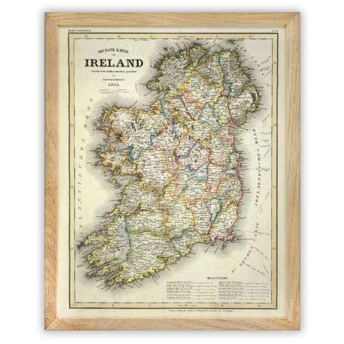
This compact vintage-style print suits buyers who want Irish cartography as room decor without filling a large wall. Its 1844-inspired design brings an aged, historical look to a study, living room, or genealogy space.
The listed frame is made with natural solid oak, plexiglass, and MDF backing. Versatile hanging hardware allows display in either orientation. It is a strong choice for shoppers seeking a framed map and a gift for someone interested in Irish heritage or history.
- Best for: Small spaces and buyers who want a framed vintage map.
- Why it stands out: The oak frame and antique cartography combine display convenience with historical styling.
- Consider: Its 11 x 14-inch size is more compact than the other framed option.
National Geographic Ireland Classic Wall Map

At 30 x 36 inches, this is the largest listed choice and is better for a classroom, office, or gallery wall where viewers need a prominent map. National Geographic describes it as a classic map for home or office and notes that it is printed on polypropylene for clear color and legibility.
Choose this print if visibility and general geographic reference matter more than antique styling. Its educational focus makes it suitable for helping students build an understanding of Ireland’s geography.
- Best for: Classrooms, offices, and large wall displays.
- Why it stands out: Its large format and legible, colorful print favor viewing and learning.
- Consider: The supplied details do not specify a frame, so check the display requirements before buying.
Lone Star Art 1792 Ireland Map Print

This 11 x 14-inch poster is suited to buyers who prefer an older historical look and want to choose their own frame. Its 18th-century map theme and sepia styling make it a decorative option for Irish history collectors or rooms with vintage-inspired decor.
The product information explicitly says this is an unframed print, not a thick sign or a print on wood or stone. That distinction makes it more adaptable to custom framing, but buyers will need to arrange a frame separately.
- Best for: Shoppers seeking antique-style art with their choice of frame.
- Why it stands out: The 1792 theme offers an older-period look than the 1844 prints.
- Consider: A frame is not included.
Lone Star Art 1844 Ireland Map, 16 x 20

Choose this version if you want the historical character of an 1844 Ireland map in a larger framed format. The product description says the vintage reproduction shows Irish counties, regional boundaries, and period place names, making it relevant to history-minded buyers and people interested in family research.
Its natural solid oak frame, plexiglass, and MDF backing offer a finished presentation. The hanging hardware supports display in either orientation. Compared with the 11 x 14 version, this is the better fit when you want a more substantial wall presence.
- Best for: Buyers who want an 1844 map with more display area.
- Why it stands out: The listing identifies counties, regional boundaries, and period place names.
- Consider: Its larger dimensions need more wall space than the compact framed print.
Tiger Moon Ireland Physical Map

This 16.5 x 23.3-inch laminated paper map is the practical choice for buyers more interested in Ireland’s landscape than historical cartography. Its listed features include rivers, elevations, coastlines, cities, towns, and roadways, which support geographic learning and trip planning.
Choose it when natural features and a contemporary geographic overview matter more than antique appearance. The laminated-paper format is distinct from the framed decorative posters, so plan how you will mount or display it.
- Best for: Learning about terrain or reviewing Ireland’s physical geography.
- Why it stands out: It specifically highlights physical features such as rivers, elevations, and coastlines.
- Consider: The listing identifies it as laminated paper, not a framed print.
Buying Guide: Choosing An Ireland Map Print
Do you want historical decor or a reference map?
For vintage wall art, compare the 1792 unframed poster with the framed 1844 options. The 1792 print suits buyers who want to select a frame themselves. The 1844 versions are ready-framed and identify Irish counties; the larger version also lists regional boundaries and period place names. For modern geographic learning, the National Geographic or Tiger Moon map is a more suitable direction.
Should you choose framed or unframed?
A framed print reduces the need to source a separate frame. The 11 x 14-inch 1844 poster is the compact framed option, while the 16 x 20-inch version offers a larger display. The 1792 poster is explicitly unframed. The other map listings do not specify a frame, so verify what is included and how you plan to hang the map.
Which map details matter most?
Choose according to the information you want to see. The 1844 reproduction emphasizes historical counties and place names. The National Geographic map is described as a large, clear, educational wall map. The Tiger Moon physical map focuses on terrain, rivers, elevations, coastlines, and roads. Product dimensions also matter: measure the intended wall area before choosing a large format.
Frequently Asked Questions
Which Ireland print is best for a history enthusiast?
The 1844 Lone Star Art maps are strong options because they use vintage cartography, and the 16 x 20 listing specifies counties, regional boundaries, and period place names.
Is the 1792 Ireland map framed?
No. The product details identify it as an unframed print, so buyers need to arrange a frame separately if desired.
Which listed map is largest?
The National Geographic Ireland Classic Wall Map measures 30 x 36 inches, making it the largest listed option.
Which map shows Ireland’s physical features?
The Tiger Moon physical map lists rivers, elevations, and coastlines, along with cities, towns, and roadways.
Are the two 1844 prints the same size?
No. One is listed as 11 x 14 inches and the other as 16 x 20 inches. Both are described as framed posters with oak frames.